
Kwara

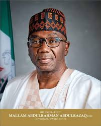
His Excellency, AbdulRahman AbdulRazaq, CON
State Governor
About Kwara
Kwara State was created on 27th May, 1967. it is a State in North Central Nigeria. It is bordered to the East by Kogi State, to the north by Niger State, and to the south by Ekiti, Osun, and Oyo States, while its North Western border makes up part of the international border, in Baruten Local Government Area, with Benin Republic. Its capital is the city of Ilorin. Kwara State consists of three (3) Senatorial Districts of Kwara Central, Kwara North and Kwara South. In the same vein, the State has sixteen (16) Local Government Areas, including: Asa, Baruten, Edu, Ekiti, Ifelodun, Ilorin East, Ilorin South, Ilorin West, Irepodun, Isin, Kaiama, Moro, Offa, Oke Ero, Oyun and Patigi; and 193 wards. Of the 36 states of Nigeria, Kwara is the ninth largest in area with 36,825km2, but the fifth least populous, with an estimated population of about 3.2 million as at 2016 (according to NBS). Geographically, Kwara State is split between the West Sudanian savanna in the west, and the Guinean forest–savanna mosaic eco-region in the rest of the State. Important geographic features of the State include rivers, with the Niger flowing along the northern border into Lake Jebba, before continuing as the border, while the Awun, Asa, Aluko, and Oyun rivers flow through the interior. In the far northwest of the state is the Borgu section of the Kainji National Park, a large national park that contains populations of grey heron, kob, hippopotamus, African bush elephant, olive baboon, and roan antelope, along with some of the last remaining West African lions on Earth. Residents of the state are sometimes referred to as Kwarans. Kwara State has been inhabited for years by various ethnic groups, primarily the majority Yoruba people that live throughout the State, but there are sizeable minorities of Nupe people in the northeast, Bariba (Baatonu) and Busa (Bokobaru) peoples in the west, and a small Fulani population in Ilorin, moving through the State as nomadic herders. Economically, Kwara State is largely based around agriculture, mainly of coffee, cotton, groundnut, cocoa, oil palm, and kola nut crops. Other key industries are services, especially in the city of Ilorin, and the livestock herding and ranching of cattle, goats, and sheep. Kwara State has the joint-twentieth highest Human Development Index in the country and numerous institutions of tertiary education. The economy of the State (both formal and informal sector) can be viewed in terms of its resources availability or endowment, commercial and industrial activities, agricultural practices and vocational practices, all of which are major determinants and as well play a major role in terms of inflow and outflow of resources in the State. Also, the State has a largely informal economy arising from a few industrial bases. However, the State Government has continued to work hard to improve the fortunes of the State in the area of industrialization.
Brief Vegetative Description Of Kwara State
Kwara State is bounded in the guinea savannah (also known as savannah woodland or wooded savannah) which is the most extensive vegetation in Nigeria’s middle belt, with a combination of trees and grass. It receives yearly rainfall in the range of 1000–1500 mm, with 6–8 months of rain. Parkland savannah, gallery woodlands, and derived savannah are all found here. An open woodland with tall grasses (1 to 3 m high) in open places and trees (up to 15 m high) with short boles and broadleaves is the characteristic vegetation. Kwara state is a vegetation transition zone between two plant communities, such as forest and grassland. It shares some of the traits of each biological community on each side of it, and it frequently contains species that are not found in the overlapping groups. It transits between derived and low land rainforest vegetation of Nigeria. Olaoye (2002) affirmed that the derived savannah ecotone of Nigeria is characterized by high evapotranspiration rates, and variable seasonal rainfall. The soil is mostly loamy to sandy type. A substantial amount of clay is found also.
Brief Geological Description
The landscape of Kwara State which is generally undulating is marked by numerous domed or sugar-loaf hills and by occasional flat top ridges. These hills which are developed over the basement complex have their summits ranging between 300 and 600 meters above the sea level. Kwara State falls within the basement complex region of Nigeria known as the hard rock terrain, where availability of groundwater is dependent mainly on structural features (such as fracture, weathered basement, etc.), and their dispositions to yield groundwater. Agriculture is the main source of the state’s economy and the principal cash crops are: Cotton, Cocoa, Coffee, Kolanut, Tobacco, Beniseed and palm produce. Kwara state is home to Shonga Farms, a product of the Back-to-Farm project. Shonga Farms is made up of 13 commercial farmers. Mineral resources in the state are Petroleum, Gold, Limestone, Marble, Feldspar, Clay, Kaolin, Quartz and Granite rocks.
Environmental Challenges In Kwara State As It Links To Acresal Project Development Objective (PDO):
i. Farms destruction from erosion, floods and gullies (resulting from overflow from Jebba Dam and similar issues across the 16 LGAs); ii. Poor access to water for irrigation and consumption due to climate change and global warming issues; iii. Erratic rainfalls/Changes in the rainfall patterns; iv. Deforestation/ Trees harvesting for charcoal production and the likes; v. Seaweeds (hyacinth) infestation on rivers and dams as a result of agricultural activities around the rivers/dams vi. Farmers encroach on water bodies due to poor irrigation systems; vii. Waste management issues (leading to erosion and deposition, sediment weathering of soil).
